
Well, I am sure you managed to catch a breath between the last post and this one. It is what happens when its raining in El Salvador – plenty of time for catching up with writing but intermittent internet so the posts pile up on the computer and get uploaded when the connection returns.
Anyway – to continue with our journey up the Pacific Coast of Costa Rica – having ended the previous post in Quepos.
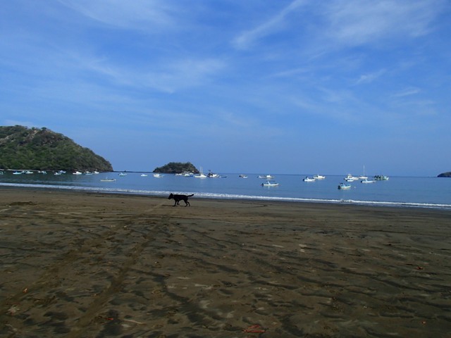
Sailing north [in the early morning of 18th August], just north of Quepos Bay we spotted some yellow markers….
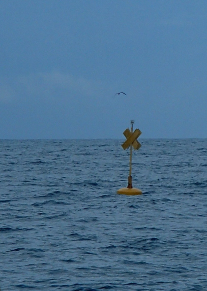 ….which were not on the chart or mentioned in the guide. They seemed to surround what looked, from a distance, to be a large fish farm. They look as though they are lit at night but, for any sailors reading this post and planning to cruise the coast in this area, by keeping to the landward side of 09 25.6N, 84 16.3W and 09 25.8N, 84 17.8W you will be safely clear to the east of the farm.
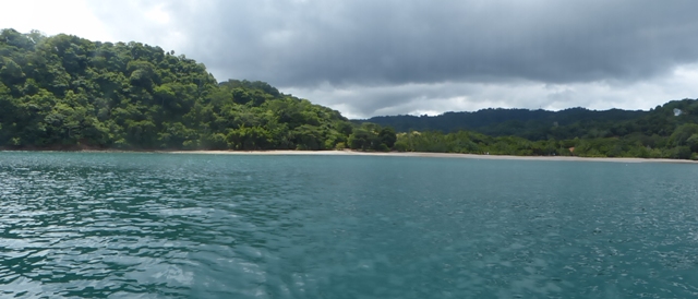
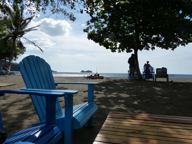
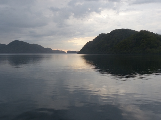
When we originally planned our route the intention was that our first anchorage after leaving Quepos would be Bahía Herradura. This would enable us to visit Jaco – another small surf town. However, after our experience at Dominicalita with the surf landing, noting that the cruising guide described Herradura as rolly and a rocky bottom and having re-read the Lonely Planet entry about Jaco we wondered why we had ever considered stopping there – so we didn’t. We decided instead to continue on for a further 12 miles to Punta Leona. Good decision. Despite the fact that on approach it looked as though we would not get much protection the opposite was true and we spent a very calm night in peaceful surroundings. A small hotel on the shore, which you can just see in the midst of the trees, was the only other thing in the bay.
 We had a relaxed start the following day because it was only a 21 mile passage across the Golfo de Nicoya to Bahía Ballena. We also hoped that by leaving it a little later in the day our directly west course would give us favourable winds from the SW if they developed late morning as they sometimes did. Hurrah – another good decision – we flew across the Gulf in just over three hours and anchored off the fishing village of Tambor at the southern end of the bay.
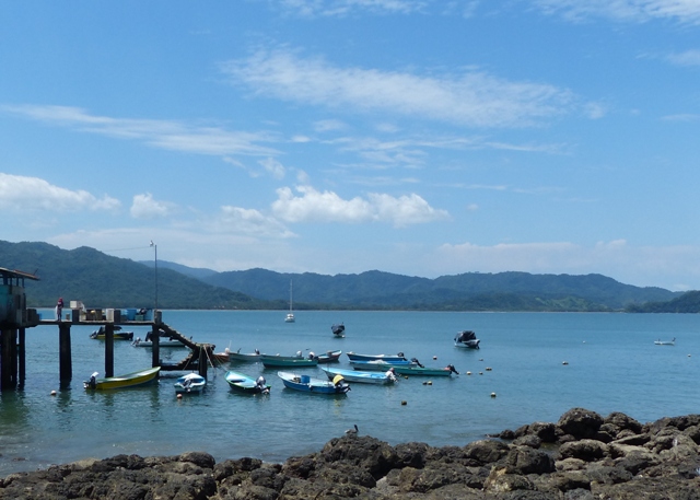 Like several of the larger Costa Rican bays there are alternative anchorages to be found dependent on the conditions – but with a southern swell and winds from the south this spot was ideal for us. Being just off the fishing village meant that going ashore was only a short dinghy ride – though, once again, a very long haul up an almost flat beach. In the trees around the village we several squirrels….
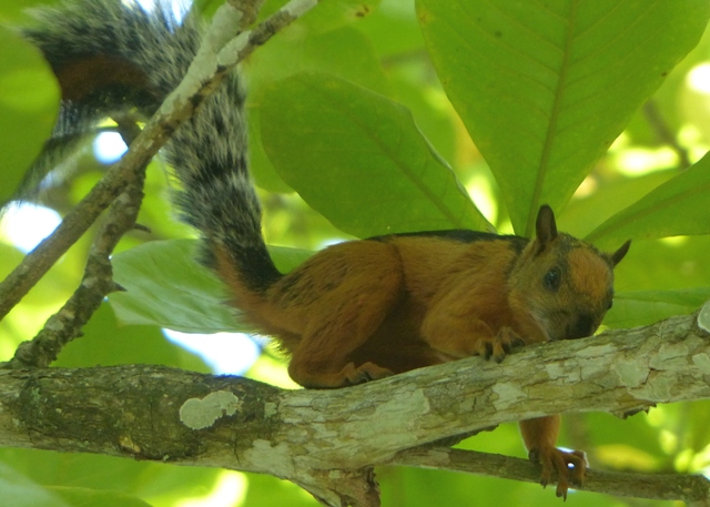 ….guess they can’t decide whether they are red ones or grey ones!
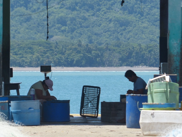
It also meant fresh fish for dinner, caught by the local fishermen….
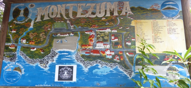
 I now seem to be contradicting myself about the whole surfing scene [remember I didn’t think much of Dominical and avoided Jaco] when I tell you that the following day we chose to take a bus ride to the surf town a little further down the peninsula. Well we just had to go given its name….
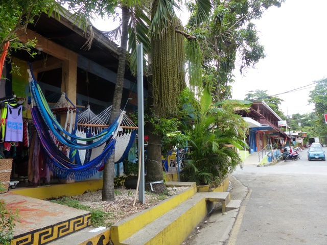
 It was more like the surf towns I imagine with shops selling hammocks and surf gear and small cafes which even had croissants….
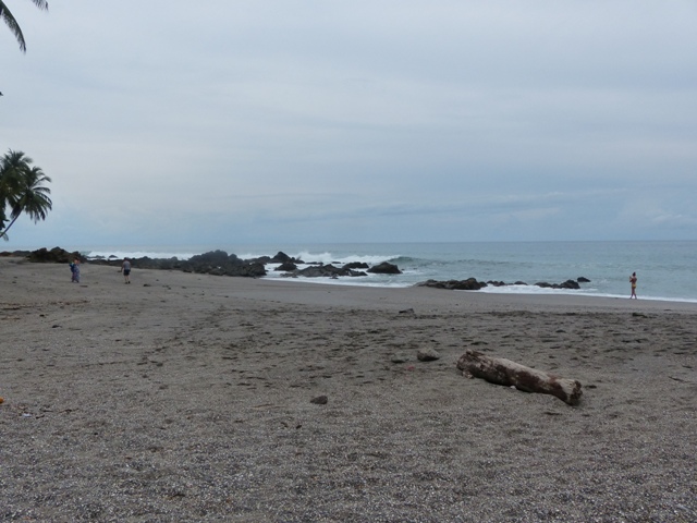
 Again, the beach didn’t exactly remind me of Cornwall….
 ….but we did enjoy a short walk [30 minutes each way] to what was promoted as “a lovely waterfall, where trying to leap across the falls was considered an act of “Darwinism”.
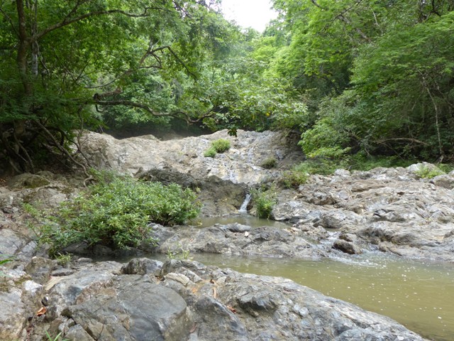 Given that we are in the middle of what is supposed to be the rainy season, the lack of cascading water gives you an indication that either this year has been different because of the El Niño event, or global warming is having a significant impact. We have spoken to quite a few Costa Ricans who tell us that although there has been rain in the mountains, the weather along the coast has been much hotter than normal at this time of year. We also know that in Panama, the lack of rain this season has resulted in water rationing, electricity cuts [mainly hydro-electric power] and the draught of large ships transiting the canal being reduced [i.e. the deeper draught boats can’t get through]. Makes you think.
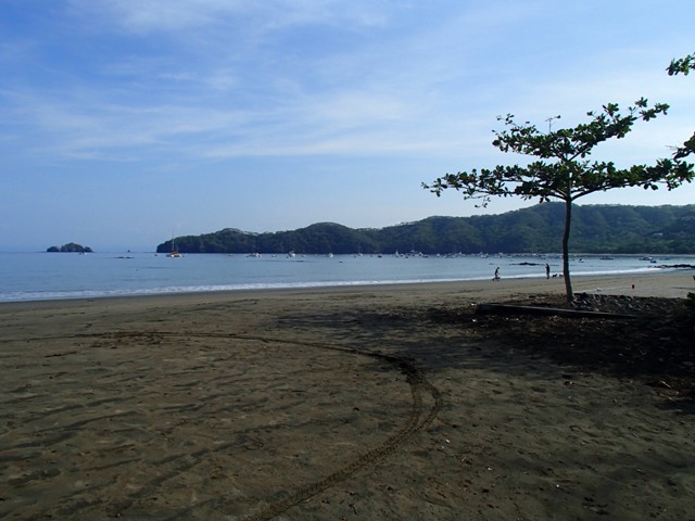
Leaving Bahía Ballena we anticipated another full day passage to Bahía Sámara – given that it was almost 50 miles and around another point. However, our worst fears didn’t come to pass and we covered the miles in around 8 hours. It was a very strange anchorage, the waypoint putting us level with a gap between the mainland and an island allowing the waves to come through onto our port side and a reef to starboard [or the other way when the wind changed!]. The breaking reef felt really quite close…..
 …..but the holding was excellent and we didn’t come to any grief.
We only stayed one night, did not venture ashore and left early next morning to arrive at Tamarindo seven and a half hours later. To access this anchorage we had to go north past it before turning east and then south again to avoid a reef. Its a good job we used the guide waypoints because it was impossible to see the reef even when we knew it was there. We anchored just to the north and west of several large catamarans on moorings. They were attached to their mooring balls with lines about the same length as the boat so had a much longer swinging circle [around 50metres] than usually found with moored boats]. Fortunately, given the length of rode we wanted to put out, we had left enough room between us and them.
The following day we were confined to the boat as we had our first taste of Papagayo winds [more about those later] which rose throughout the day to Force 6. However it was a short lived blow and, by the following morning, things were back to normal again meaning we could go ashore.
 Tamarindo is another popular tourist [and surfing] town and, being slightly larger, had two supermarkets where we were able to restock with some fresh produce – though only frozen meat was available [and just chicken and sausages at that].
From Tamarindo we sailed a short hop to Bahía Brasilito. This is a huge bay with anchorages on the north, east and southern edges. We chose Playa Conchal – the southernmost anchorage.
 It has been very strange cruising Costa Rica at this time of year. Whilst we know it is the season when many cruisers put their boats in marinas and go home or travel inland we expected to see one or two other boats around – but no-one at all shared our anchorages – except, of course, the tourist tripper boats.
Whilst swimming off the back of the boat in the incredibly clear and blue water Mike, who was sitting on the transom, said something like “Come here a minute and get out of the water and look at this”. “This” turned out to be this…….
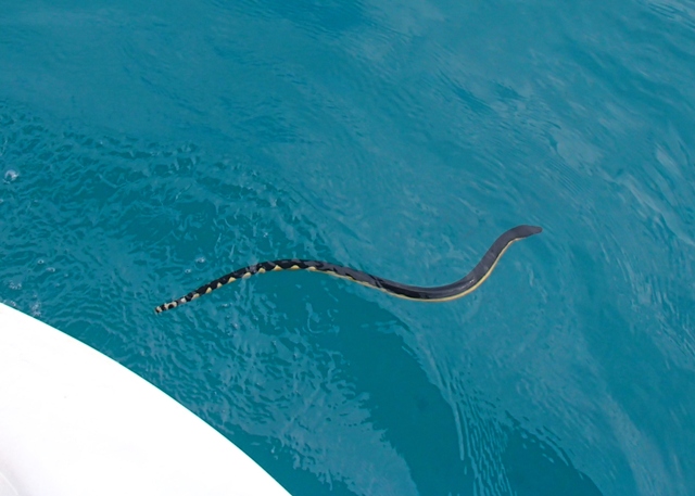 …. a “Pelamis Platura” – yellow bodied sea snake. Apparently, although venomous, they don’t/can’t bite humans because their mouths aren’t big enough. Don’t fancy giving it the chance myself so I was very glad, first of all, that Mike saw it and that, secondly, he didn’t just yell “Snake”. Not sure what my reaction would have been but I don’t think it would have been pretty!
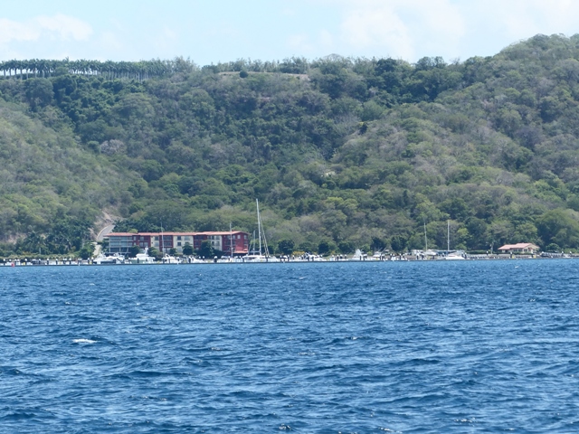
27th August and another change of mind when our planned sail round the point to Bahía Guacamaya -5 miles – turned into a 19 mile journey to Bahía Culebra because we thought Bahía Guacamaya looked rather uninspiring. Either luck was on our side or we were actually inspired by deciding not to stop. Two hours later as we approached Bahía Culebra strong winds got up which, for the next few hours increased [they had been between 4-11kn] up to 22-25kn from the NE with gusts of 30+kn. Guacamaya is a north facing bay and we would have been totally exposed. As it was we were able to make our way to the northern end of Bahía Culebra and anchor just off the beach to the north of Marina Papagayo [just to the right of the marina as shown in the photo below].
 Given that we wanted to come to the marina for a final fuel top up before leaving Costa Rica we didn’t mind heading way up into the bay especially as we got good protection from the blow. So, the following day, refuelled, we went back south down the Bay heading for Bahía Hermosa – from where we thought we could catch buses for our National Zarpe clearance in with the Port Captain at Playa del Coco and our eventual International Zarpe clearance out with all the required officials.
Part way across the bay we saw a couple of whales. We had seen some three or four times previously – but this was the first time we managed to take photographs which at least suggest they are whales.
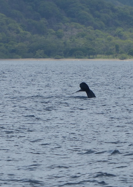
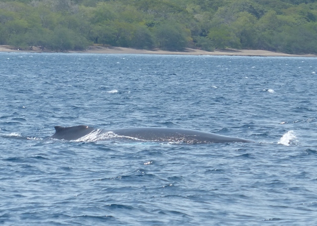
I have tried to identify them on the internet. The tail of a humpback is black and white so the photo above of the tail may be what is known as a pilot whale but which is actually a large dolphin. However the other photo may actually be a humpback whale as these whales pass through Costa Rica from August to October and it does look like some of the humpback whale photos I researched. Shame I didn’t get its head as that would have been much more defining.
Anyway, Bahía Hermosa beckoned and we found a good anchorage just to the north of the moored boats. There is some surf here but it is not a surf beach as such and therefore landing the dinghy [and leaving again] was OK.
Although a popular holiday bay there isn’t very much there except a few small hotels and some very pleasant beach bars…..
 It was a really calm and sheltered spot and we enjoyed the sunset – which coincided with the moon rise….
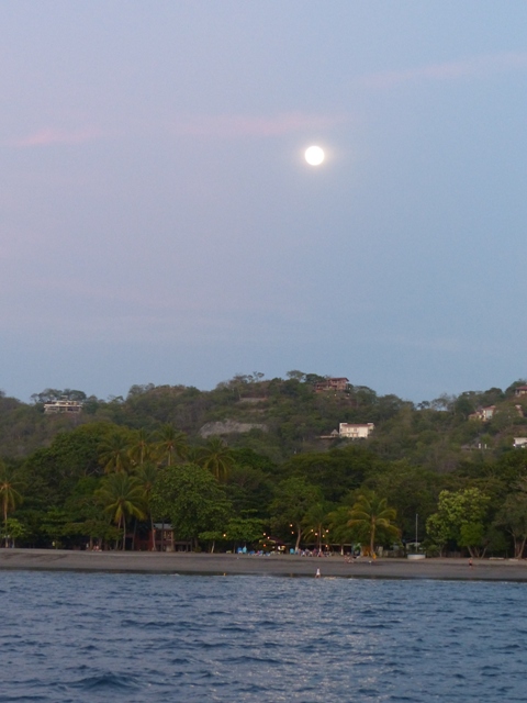
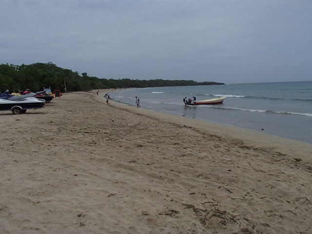
Having walked around we realised that catching the bus to Playa del Coco wasn’t going to be as easy as we had hoped. There were no bus times published and all we could find out was that there were a couple a day. Rather than wait for hours for one to arrive in either place and/or get stranded in Playa del Coco we decided to take the boat round the point – it only took an hour and we had the choice of anchorages to the north or the south of the central reef. We chose the north – at the very right hand end as seen on the photograph below.
 This kept us clear of all the moored local and tripper boats. However, it was rather a long walk into town – not that we minded on the way in but, carrying beer and provisions back was a bit of a pain. What was even more of a pain was that, rather than the benign waves on landing, this surf beach really lived up to its name at high tide. We sat for about half an hour watching the waves and picked our launch point which seemed to escape the worst of them. We also counted them and worked out when the lull would be, got ourselves ready to run the dinghy into the water and jump in when – you got it – not one, but two huge waves swamped us and the dinghy. The first sent me rolling off down the beach and also turned the dinghy broadside – just ripe for tipping. As the second one hit, Mike leapt across the dinghy to prevent this and ended up upside down – but in the dinghy with the dinghy still upright. We scrambled back to the beach. Three local guys had watched all this happening [no doubt finding it highly amusing] but they did come and offer assistance. Between the five of us we got the dinghy out far enough to lower the outboard for a quick getaway which, you might realise, meant me having to get into it from a swimming start i.e. I couldn’t touch the bottom with my feet to give me a boost. So, in stranded whale fashion I managed to wriggle and flop over – very ladylike I am sure. I was glad I had kept my t-shirt on as my bikini top was, by this time, not where it should have been and I didn’t want to give the local guys even more of a laugh! Ah well, nothing broken – except one egg which given the pounding we had taken was pretty good going.
Knowing we had to go ashore again at least once – for clearance – we moved to the south end as, when we had looked at it from the beach, it seemed less affected by big surf.
 It was actually a less crowded spot anyway – mainly fishing boats and we watched where they landed their pangas so that the following day we would know what might be the safest spot. In the end we went ashore twice from this southern anchorage and on neither occasion did we have a mishap. We liked the southern anchorage!
As with clearance in, clearance out took all day. This was partly because it involves a bus ride towards Liberia as Customs is situated near the airport there. Buses are approximately every hour and we caught the 08.30 and the driver put us off right across the road from the custom office door approximately 45 minutes later. The process didn’t actually take that long but we obviously just missed a return bus because we had a 50 minute wait – in zero shade and temperatures in the high 90’s – for the bus back to Playa del Coco to arrive.
We then had to go to the bank to pay for our International Zarpe to leave – we had been given the paper authorising this from the Port Captain when we had called at her office before going to customs. The cost for a boat our size was $20 [approx £14]. I think for boats over 50ft it was $25 [approx £17.50]. The other reason for the length of time taken was that Immigration will only give a 3hr exit window. Because their office closes at 5pm, for an early morning departure this means you can’t get stamped out until 2pm. It may seem a bit bureaucratic – but there was nothing to be done about it other than waste 2 hours in town.
Although Playa del Coco is the northern most clearance point there are several anchorages available before actually leaving the country. Given the 3 hour rule imposed on us by Immigration we don’t know what would have happened if someone had stopped us and asked for papers but we left Playa del Coco with the intention of stopping at a couple of places at least.
It is probably at this point that I should tell you some more about the Papagayo wind – a North to North-Easterly wind which blows periodically through the gap in Central America passing over Lake Nicaragua. The winds are supposed to be at their worst December to March with the shoulder months also affected. The winds can, during these periods, blow for days or even weeks at a time and make passage between Costa Rica and Nicaragua or El Salvador very uncomfortable at best and often quite hazardous. They are not supposed to blow May to September/October and so, in late August/early September we should have been fine. However, this year they never actually went away and my comments above – regarding strong winds on two occasions – are about unseasonal Papagayos. Granted, they only lasted 12-24 hours, but rounding Punta Santa Elena and/or crossing the Gulf of Fonseca can be nasty if this wind blows.
So, we wanted a clear weather window to get us to Bahía Santa Elena and another one to make the two night passage up to El Salvador. We knew we had to leave Playa del Coco and therefore headed for Bahía Huevos, which we had read was a very popular bay and, although only 7 miles from Playa del Coco a good place to stop before making the run up to Punta Santa Elena.
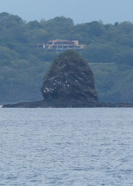
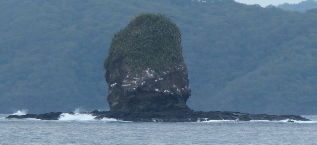
The route from Coco [or Hermosa] to Huevos passes “King Kong” rock. That is what it seems to be known as and with a bit of imagination…..
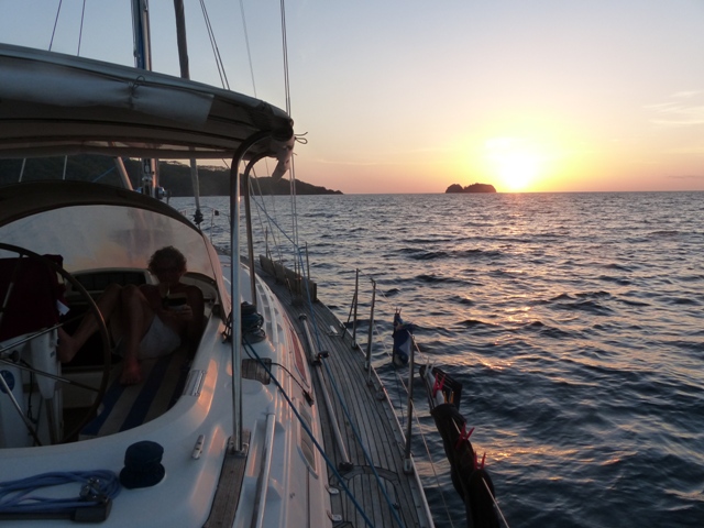
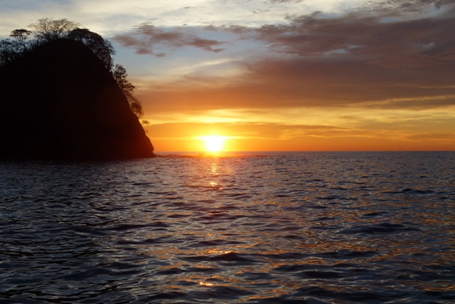
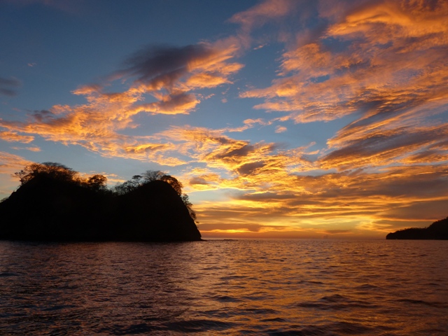
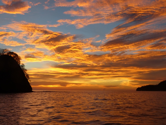
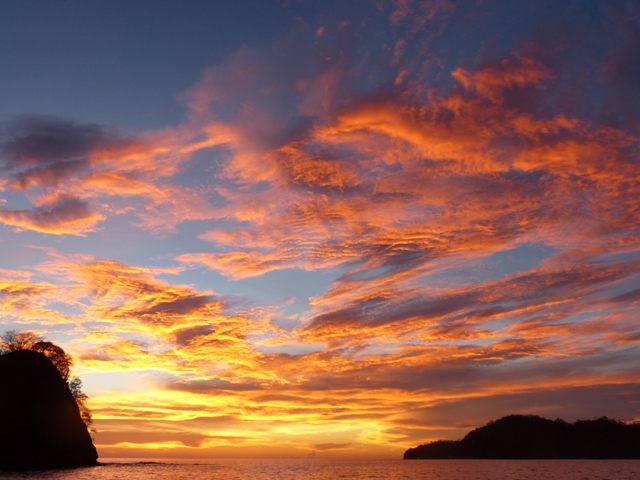
On entry into Huevos bay we saw winds gusting 30kn. This wasn’t a Papagayo event – just a squall – but even so we were glad we had an anchorage close by. Again, a choice of three anchorages – all of them small – and this time the eastern anchorage was the one we favoured as it protected us from almost all sides. We spent a very pleasant evening there and if you will forgive me, here are four photographs chronicling the fabulous sunset…..
Our final anchorage in Costa Rica was Bahía Santa Elena. As the crow flies it is around 10 miles from Bahía Huevos on the south side of the Santa Elena peninsula to Bahía Santa Elena on the north. But, by sea it is around 37 miles. Leaving at 6am in the morning we hoped to make the passage by early afternoon and, indeed, we dropped anchor at 14.35. Sounds simple doesn’t it. No such thing. We averaged 6kn along the southern side but we then rounded the point and stopped. Not literally, fortunately, but it felt like it. The waves were both big and confused and for the next 3.5 hours we averaged 3.5kn per hour. We debated heading off NW straight to El Salvador but whilst the weather forecast for that day and night [3rd Sept] was good, it was poor for the night of the 4th – which is why we had planned for Santa Elena and not for a two night direct passage. So we battled on and, having rounded the northern point we stopped bashing into waves, the wind was now in our favour and we increased speed for the four miles remaining.
Bahía Santa Elena is almost landlocked and is a very safe anchorage in all conditions. Whilst the wind can whistle over the surrounding hills the eastern anchorage point protects the boat from fetch so it is very secure and we settled in for two nights.
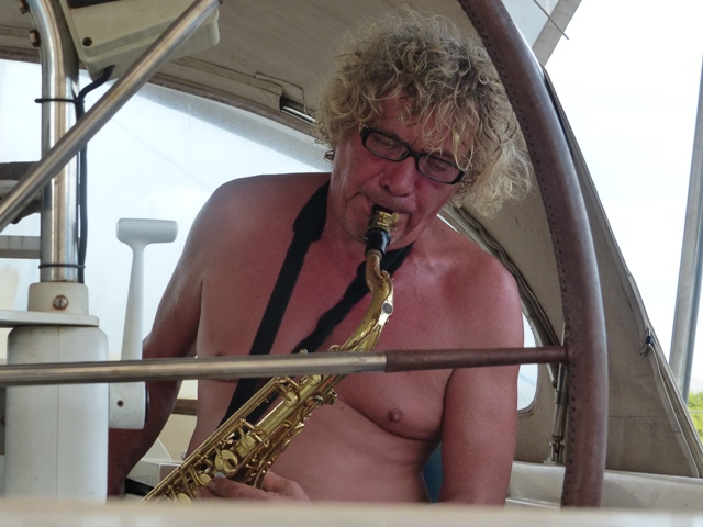
We made final preparations for the two night passage like putting the dinghy on deck and tried once again to test the AIS which, despite various e.mails back and forth to Digital Yacht, still won’t send data. I also passed the time cleaning the fridge [must be something from Nikki rubbing off there!] whilst Mike found something much more fun to while away a couple of hours….
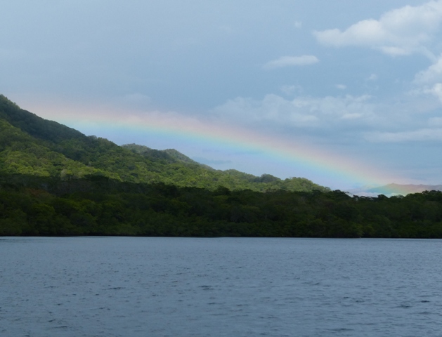
 The bay reminded us somewhat of Scotland…….
 …. and we saw our first rainbow in a long time.
 We were joined both afternoons by a couple of local fishing boats.
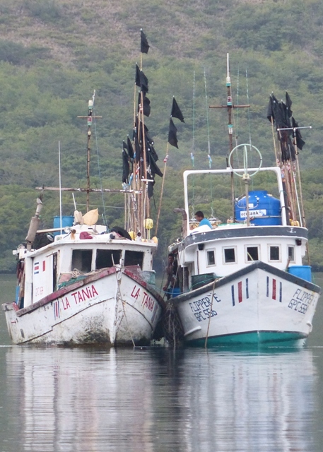 Note all the black flags – these are attached to the fishing lines – which is all well and good if you come across them during the day – but they went out at night!!!!! To be fair, we saw a lot of boats during night passages with lights on. True, there may have been others we didn’t see but we think that they are quite good about lighting up even if it is only one white or yellow light. Just be aware that their lines are fairly long and give them a wide berth.
So, that was it. On 5th September we left Costa Rica and that is where I will end this post other than to sum up our thoughts about cruising in this country.
To start with the negatives. Most of the anchorages involve long dinghy hauls up the beach as there are very few dinghy docks. Many of the beaches involve surf landings. Eating out is expensive for Central America and fairly boring – unless you like rice and fried plantain with every meal [including breakfast if you so wish]. Marinas, if you want to/have to use them, are also expensive – more so for transient short term stays. Provisioning and the variety and quality of food in general is average [Playa del Coco was the exception so, if you are travelling north to south, take advantage of the supermarkets there. If you are coming from the south, stock up in Panama].
On a positive note. The cost of clearing in and out is minimal [$20 – $25] and anchoring is free – except possibly in National Parks. The anchorages [in fact the whole coastline and the National Parks] are very beautiful. In most bays there are possible anchorages to suit most conditions and we found the holding to be excellent. We saw birds and animals we have seen nowhere else in Central America. The local people are very friendly and helpful.
Overall, we think the positives outweighed the negatives and we are glad we took the time to visit Costa Rica.
1 comments
Wonderful.Still have to have that Jam session Mike! Very inspirational narrative! Love the pics too! Thanks Dawn